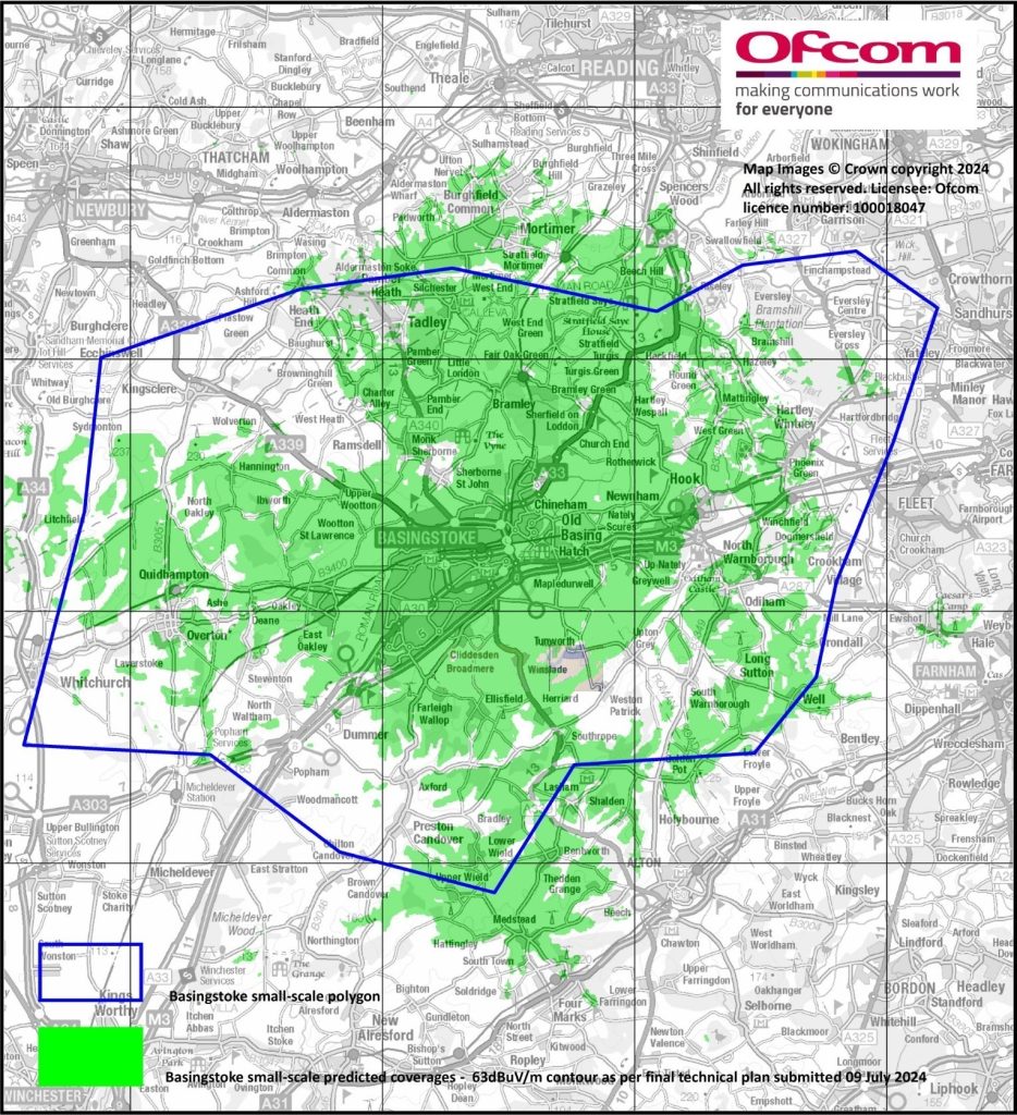
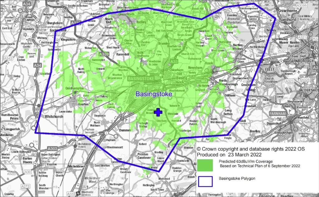
Below are the Ofcom predicted coverage comparison maps showing indoor signal coverage from the current and previous Basingstoke DAB transmission sites.
Looking into Basingstoke, there is not a great deal of difference in coverage between sites, though the current site does show a marked improvement in coverage to areas in the south of Basingstoke.
Bearing in mind that when Basingstoke DAB was located at the higher cost, original “premium” site at Swallick Farm, it shared the same antennae as the local and national DAB services, so we are very pleased with the results from our “independent” site. Importantly, this was also more affordable for a small-scale DAB operation, which helps to ensure the financial security and sustainability of the service going forward.


Coverage shown is for predicted indoor coverage (63dBμV/m at 10m above ground level)
Please note the following caveats:
a) The maps are based on computer predictions rather than actual measurements, so are indicative only.
b) ‘Receivable’ is based on the defined signal level required by a receiver that meets the minimum receiver specification (available here: Minimum specifications for DAB and DAB+ personal and domestic digital radio receivers: Digital radio action plan report – GOV.UK (www.gov.uk), although that may not be adequate for receivers built to a poorer sensitivity, or be sufficient in every location.
c) The maps do not take account of any interference from other DAB digital radio services. The likelihood of any such interference will increase as more DAB services are launched, but Ofcom will seek to reduce the impact as far as is reasonably practicable.
d) The maps do not show where reception outside homes (e.g. along roads) may be possible.
